This exploration is for all ages, as the colored smilies show. You can color the map of Ancient Egypt with your whole family together!


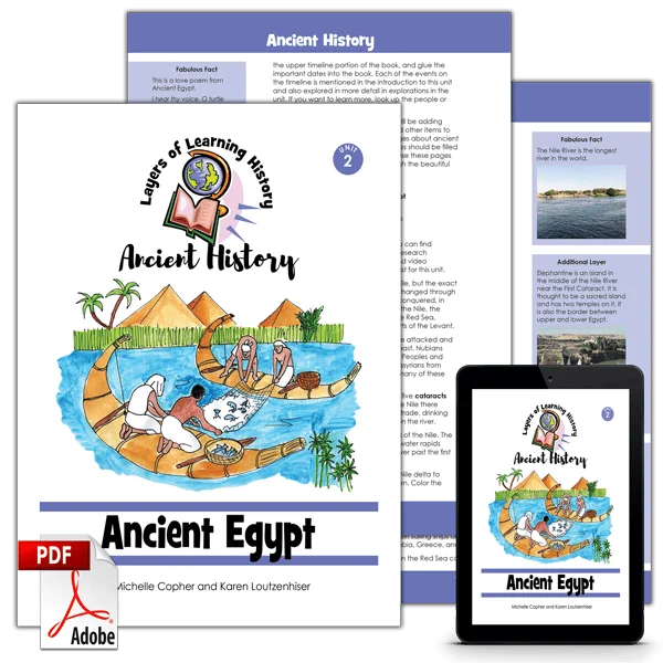
The map of ancient Egypt is an exploration from the Ancient Egypt unit of the Ancient History course.
Historical maps are a great tool for understanding the past. You can see when you look at a map of ancient Egypt why people lived only along the river. What would the land have been like away from the Nile?

Ancient Egypt was centered around the Nile, but the exact borders that were ruled by the pharaohs changed through the centuries as they conquered or were conquered in turn. Besides the land directly adjacent to the Nile the Egyptians controlled important ports on the Red Sea, several fertile oases in the Sahara, and parts of the Levant.
During their long history the Egyptians were attacked and conquered by Canaanites from the near east, Nubians from the south, Berbers from the west, Sea Peoples and Greeks from the north, and Persians and Assyrians from Mesopotamia. In return they conquered many of these lands themselves.
Step 1: Library Research
Before you begin exploring, read a book or two about ancient Egypt. Here are some suggestions, but if you can’t find these, look for books at your library about ancient Egypt, mummies, pyramids, the Nile River, and Egyptian mythology. The colored smilies above each book tell you what age level they’re recommended for.
As Amazon affiliates, the recommended books and products below kick back a tiny percentage of your purchase to us. It doesn’t affect your cost and it helps us run our website. We thank you!

Everything Ancient Egypt
by Crispin Boyer


Ancient Egypt: An Interactive History Adventure
by Heather Adamson

Cat of Bubastes
by G.A. Henty
Step 2: Ancient Egypt Map Exploration
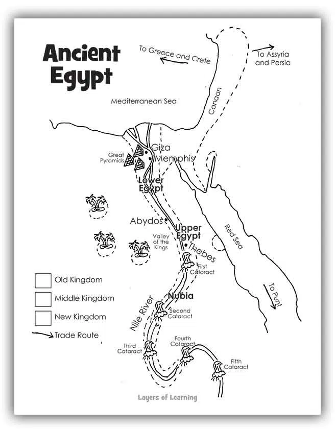
To complete this exploration you will need colored pencils and a printable Ancient Egypt Map.
When you color a historical map of ancient Egypt you can see the boundaries of the Old, Middle, and New Kingdoms and why the older kingdoms ended at the second cataract of the Nile. You can draw on trade routes and maybe even guess at why those traders took the routes they chose.
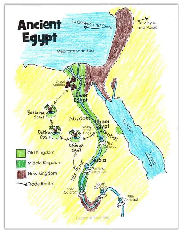
How to Color the Map of Ancient Egypt
- Color the five cataracts and the Nile River light blue. Without the Nile there would be no Egypt. Farming as well as trade, drinking water, and transportation depended on the river.
- Look up images online of the cataracts of the Nile. The cataracts are small waterfalls or white water rapids along the Nile. No boats could sail upriver past the first cataract.
- Color the Old Kingdom lands from the Nile delta to just past the second cataract light green. Color the Old Kingdom in the key light green to match. This was the portion of Egypt that the first kings ruled from their capital at Memphis.
- Color the palm trees and the water in the oases. Then color the land around the oases light green as well. Label the oases from north to south: Bahariya Oasis, Dakhla oasis, and Kharga Oasis.
- Draw trade route arrows from Kharga oasis to Thebes and towards the third cataract. From the time of the Old Kingdom caravans of donkeys carried gold, ivory, spices, exotic animals and wheat along that route to and from Kush and Sudan. Draw more trade route arrows between the oases and then up to Memphis.
- The Old Kingdom people built the Great Pyramids. Color the Great Pyramids brown.
- Color the Mediterranean Sea and the Red Sea light blue. The Egyptians built sailing ships and traded across the sea with Punt, Arabia, Greece, and Crete.
- Color the half circle on the Red Sea coast near Thebes light green as well. The Old Kingdom Egyptians had several ports along this coast. They took wheat, salt, and copper south to Punt and Arabia where they traded for gold, ivory, animals, exotic wood, and spices.
- Color the Middle Kingdom in the key dark green. Color the lands up to the third cataract green. The Middle Kingdom kings regained the lands of the Old Kingdom after they lost them to invaders. Then they also took a little bit more of the Nile to the south. They moved their capital to Thebes.
- Color the land near the Nile up to the fourth cataract brown. Color the Sinai Peninsula up through Canaan brown as well. Color the box in the key next to “New Kingdom” brown. The kings of the New Kingdom began to call themselves pharaoh and spent a lot of time and money on conquering their neighbors. They started with their capital at Thebes and then moved it to Memphis.
- By the time of the New Kingdom the tombs of the old kings were sacked and raided so the New Kingdom pharaohs carved hidden tombs in the Valley of the Kings near Thebes. It didn’t work though, these tombs were raided as well.
- Color the remainder of the land yellow. Except where it is fed by rivers, this part of the world is very dry. The Egyptians all lived very close to the river or in oases.
Step 3: Show What You Know
Write a paragraph (for younger kids) up to a page (for older kids) about the things this map of Egypt explains about the Ancient Egyptians and their world. You can include the reasons for the boundaries of the three kingdoms, information about the trade routes, information a out the pyramids, and more.
Additional Layers
Additional Layers are extra activities you can do or tangents you can take off on. You will find them in the sidebars of each Layers of Learning unit. They are optional, so just choose what interests you.
Additional Layer
You can also make important visual connections while making maps. This is especially important when it comes to landmarks.

If the kids are coloring the pyramids, show them a picture of the Great Pyramids from a book or the internet. You could even watch a little video clip together.
Additional Layer
Give your kids something to discover on their own.
You might say, “Do you know what a cataract is?”

Have the child look up the definition of a cataract and then search for images or videos on the Egyptian cataracts.
Fabulous Fact
The land of Punt, a trading partner of the Egypts, was mentioned often in Egyptian writings. But today no one knows for sure where it was located.
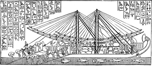
Learn more about the Land of Punt.
Get a Free Unit
Choose between the first unit in each Layers of Learning subject to try for free when you sign up for the newsletter.
We never spam and you can cancel your subscription at any time.



I’m looking forward to using these Egyptian resources, especially the map. It looks wonderful. Thank you.