
This exploration is for all ages, as the colored smilies show. You can do this printable map of Japan activity with your whole family together!


This printable map of Japan is part of The Far East, which features Japan along with China, North Korea, and South Korea. Along with has hands-on explorations, every unit of Layers of Learning also features simple printable activities for kids to complete in creative ways and add to their notebooks. Learn more about Layers of Learning.
Japan is an island nation that was formed by volcanoes and is mostly made up of mountains and forests. Only about 30% of the land is habitable, and nearly everyone lives along the coasts of the island. In fact, although we often think of it as one island, that’s not the case. it is made up of 6,852 different islands! The nation experiences many tsunamis, earthquakes, and volcanoes. Its history is full of stories of these natural disasters and how they have shaped both the land and the people of Japan.
Step 1: Library Research
Before you begin exploring, read a book or two about Japan. Here are some suggestions, but if you can’t find these, look for books at your library about the country, culture, stories, or history of Japan. The colored smilies above each book tell you what age level they’re recommended for.
As Amazon affiliates, the recommended books and products below kick back a tiny percentage of your purchase to us. It doesn’t affect your cost and it helps us run our website. We thank you!
I Live in Tokyo
by Mari Takabayashi

A Treasury of Japanese Folktales
by Yuri Yasuda

Japan: Highlights of a Fascinating Country
by Monaco Books

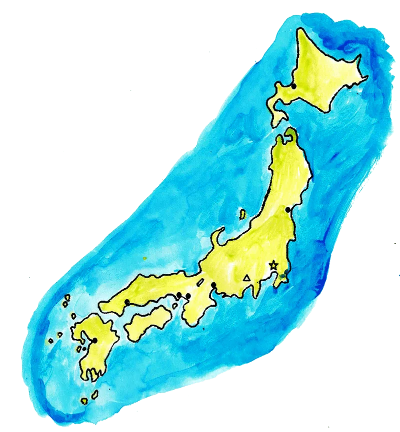
Step 2: Japan Map
To complete the Japan mapping exploration, you’ll need colored pencils, a black pen, and the printable map of Japan.


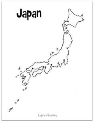
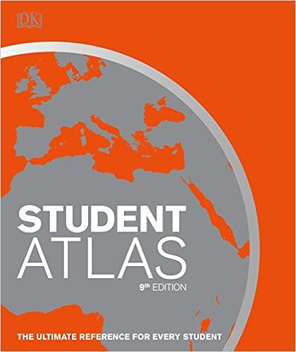
Label these places on your map with the aid of a student atlas:
- Sea of Japan
- East China Sea
- Pacific Ocean
- Hokkaido Island
- Honshu Island
- Shikoku Island
- Kyushu Island
- Tokyo
- Osaka
- Kyoto
- Kobe
- Hiroshima
- Kumamoto
- Sapporo
- Sendai
- Mount Fuji
Color the islands green to represent the forests and brown to represent the higher mountainous regions. Finally, color the surrounding ocean blue.
For Older Teens Only:
Older kids can try variations on mapping techniques. They could choose from these options:
- A population map
- A resource map showing the natural resources of Japan
- An illustrated map that shows each of the four main islands in its own color and is surrounding by illustrations and captions that feature interesting things about Japan
- A set of latitude and longitude clues to accompany the map and give to younger siblings (teens can help the little ones!)
Step 3: Show What You Know
Show off your map, noting the islands, major cities, Mt. Fuji, and surrounding seas and oceans from memory. Add your map to your geography notebook.
Additional Layers
Additional Layers are extra activities you can do or tangents you can take off on. You will find them in the sidebars of each Layers of Learning unit. They are optional, so just choose what interests you.
Additional Layer
The population of Japan is homogenous, with the same culture, race, history, and language.

How is a homogenous population different from a multicultural one like the U.S.? Make a Venn Diagram to compare the social benefits and problems of each.
Additional Layer

Learn about one of these animals that lives in Japan: Ussuri brown bear, Amami rabbit, Bonin flying fox, Sika deer, Japanese wild boar, Japanese raccoon dog.
Fabulous Fact
Japan has both Western toilets (the kind you’re probably used to) and squat toilets (which is basically a hole in the ground).

You squat low over the hole to use the restroom. These are considered more sanitary because the toilet never touches your skin.