
This exploration is for all ages, as the colored smilies show. You can explore topographic maps with your whole family together!


The topographic maps explanation is a geography lesson within the Northern South America unit. Each geography unit teaches about a part of the world and also about a geography skill. Layers of Learning has hands-on explorations in every unit of this family-friendly curriculum. Learn more about Layers of Learning.
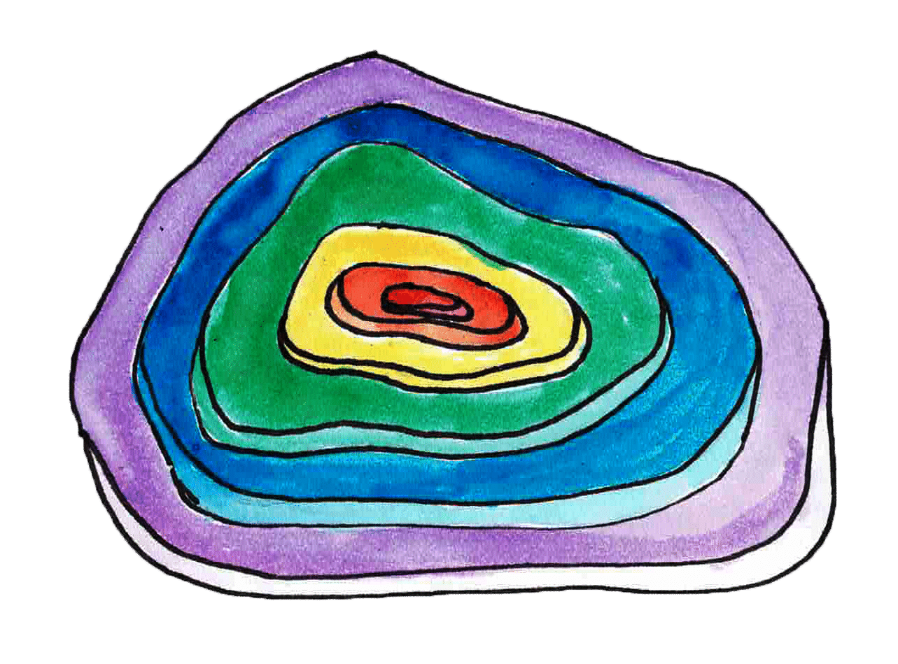
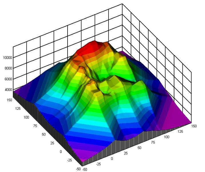
Topographic maps show topography, which is just a fancy word for elevations and landforms. If there is a mountain or a valley, you can see it on a topographic map, even though the map itself is flat. Also sometimes called relief maps, topographic maps use contour lines to show rise and fall in elevation. Each line represents a change in elevation. The more closely spaced the lines are, the steeper the pitch. Topographic maps can seem confusing and hard to decipher, but with this companion color-coded map and model you can see the changing elevation lines and how they are related.
Step 1: Library Research
Before you begin exploring, explore the pages in your children’s atlas that show topographic maps, then watch this video together that explains how to read a topo map. Layers of Learning offers YouTube playlists along with library lists, which are especially valuable for those hard-to-find topics.
Here are some suggestions for atlases we like. The colored smilies above each book tell you what age level they’re recommended for.
As Amazon affiliates, the recommended books and products below kick back a tiny percentage of your purchase to us. It doesn’t affect your cost and it helps us run our website. We thank you!
DK First Atlas
by Anita Ganeri & Chris Oxlade

Children’s Illustrated Atlas
by DK

Student Atlas
by DK

Step 2: Topographic Map Model
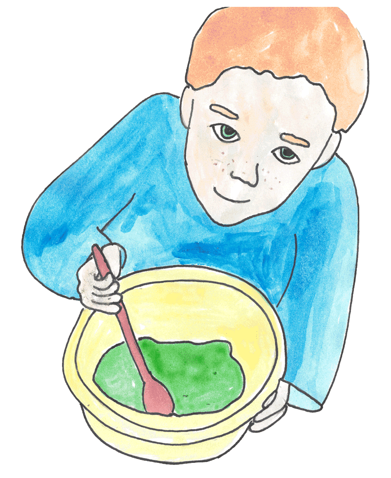
Before you begin the model, you’ll want to cover your table with white butcher paper. You’ll need several batches of no-cook play dough (don’t add colors or glitter), dental floss, permanent markers, and rulers.


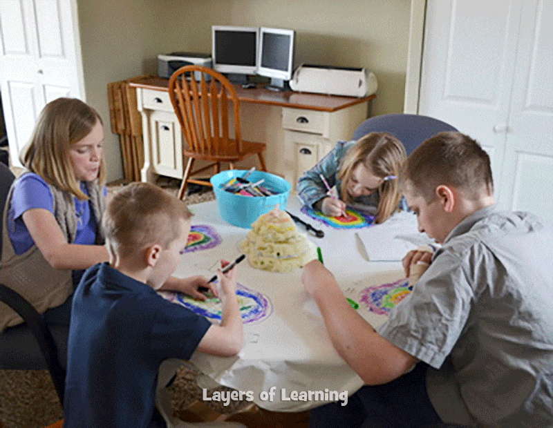
Make a big lump of salt dough and create a mountain in the middle of your table. Have your kids help sculpt the mountain.
Take turns picking up the mountain and, one by one, allow each child to trace the outline of the mountain on the butcher paper at their seat. Use permanent markers. Then put the mountain back in the middle.
Next, use a ruler to measure one inch up the mountain and slice the mountain using the dental floss right across the one-inch elevation mark. Pick up the top of the mountain, set it inside your last outline, and trace it again, this time with a different color. Pass the mountain around, taking turns tracing.
Continue this process – measuring, slicing, tracing in a new color – at each 1-inch interval until you’ve climbed to the very top of your mountain.
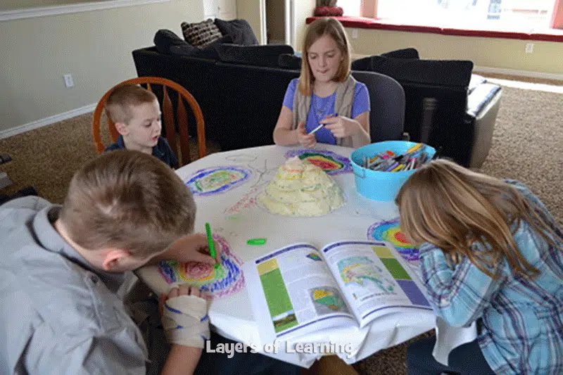
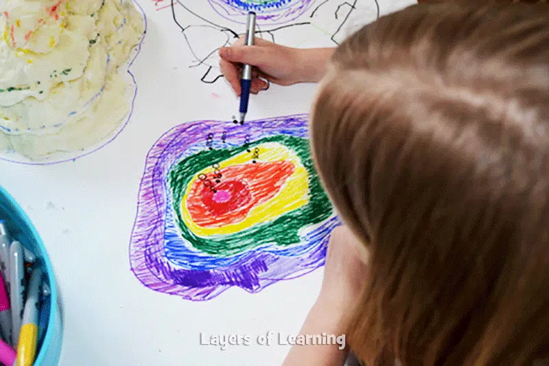
Color in your own topographic map of the mountain model, showing each elevation.
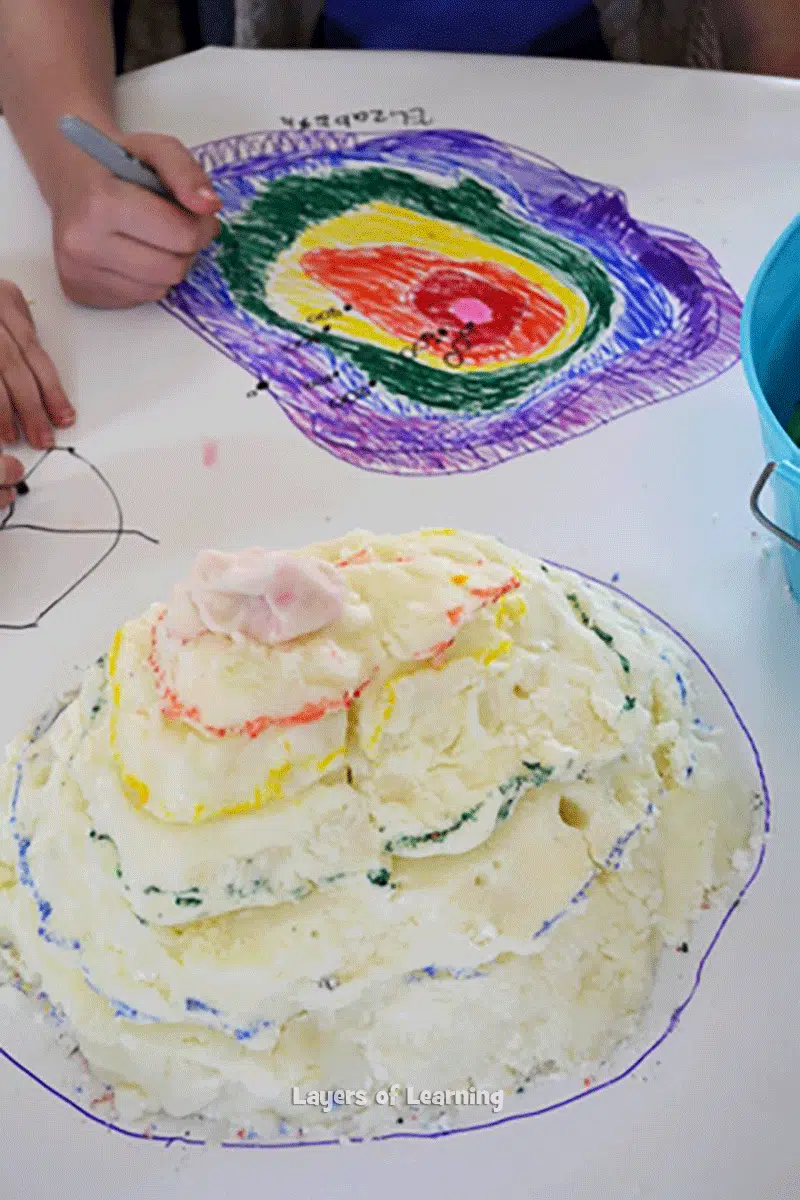
Mark the mountain with corresponding lines of color so you can see matching lines on your own map.
Talk about how on a real mountain, each of our inches would represent some number of feet. Create your own scale and label your map with a scale. Discuss how different your lines would be if they were every 2 inches or every 1/4 inch instead of one inch.
Step 3: Show What You Know
Take turns explaining how topographic maps work. Have each kid choose a familiar location (like a nearby mountain or valley) and explain what the topographic map for that area might look like.
Additional Layers
Additional Layers are extra activities you can do or tangents you can take off on. You will find them in the sidebars of each Layers of Learning unit. They are optional, so just choose what interests you.
Writer’s Workshop
Use your salt dough mountain as a story starter. Let it become a setting for a story you write.
Additional Layer
Make a list of uses for topographic maps. They aren’t really useful for getting around town, so what are they useful for?
Expedition
Go on an expedition to a mountain, valley, or anywhere that has a rapid change in elevation. Discuss how the countour lines on a topographic map of the area would look very close together