

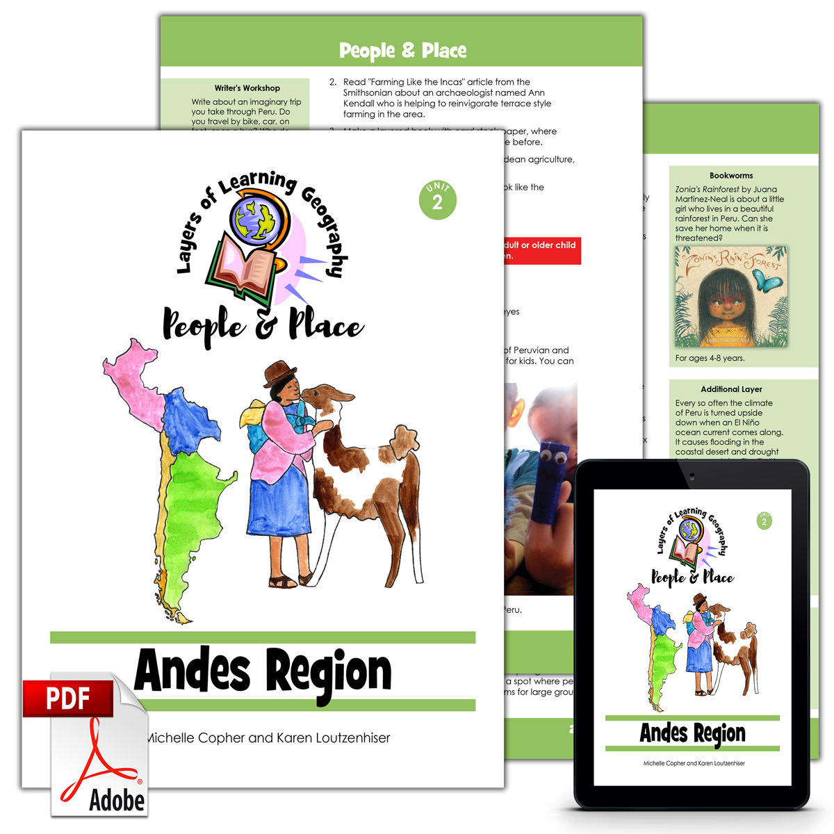
Andes Region is the second unit in the People & Place geography course. In Andes Region you will learn about world populations and demographics and then the countries of Argentina, Chile, Bolivia, and Peru.
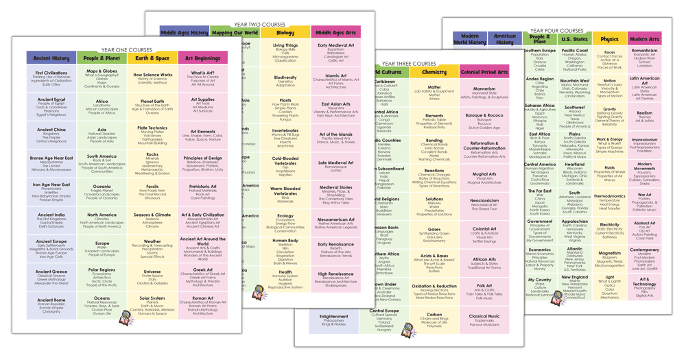
Each People & Place unit includes a skill section about human populations, government, or economics followed by a focus on a specific region of the world. By the time you complete the entire four year cycle of Layers of Learning Geography you will have covered the entire world and learned the skills and knowledge needed to analyze and understand maps, cultures, people, governments, and the planet all over the world.
This unit is a guide for the mentor to use in creating lessons and directing discussions and learning. It is not a textbook for the student.
This unit includes sections on:
- Cities
- Argentina
- Chile
- Bolivia
- Peru
Hands-on Learning
This is an activity based curriculum. You pick activities to do as you read books and watch videos about the countries of the Andes Region. Here are some of the activities found in this unit:
- Make a foldable for your World Explorer Journal about the push and pull factors of migration to cities
- Go on a scavenger hunt of your neighborhood to learn how people work together to fill everyone’s needs
- Map 30 important cities around the world
- Cook some Argentinian asado
- Make a poster about the Tierra del Fuego
- Craft a penguin out of paper plates and paint
- Draw an write facts about an Andean animal
- Make a suncatcher flag of one of the countries from this unit
- Crafts your own floating island from grasses or reeds
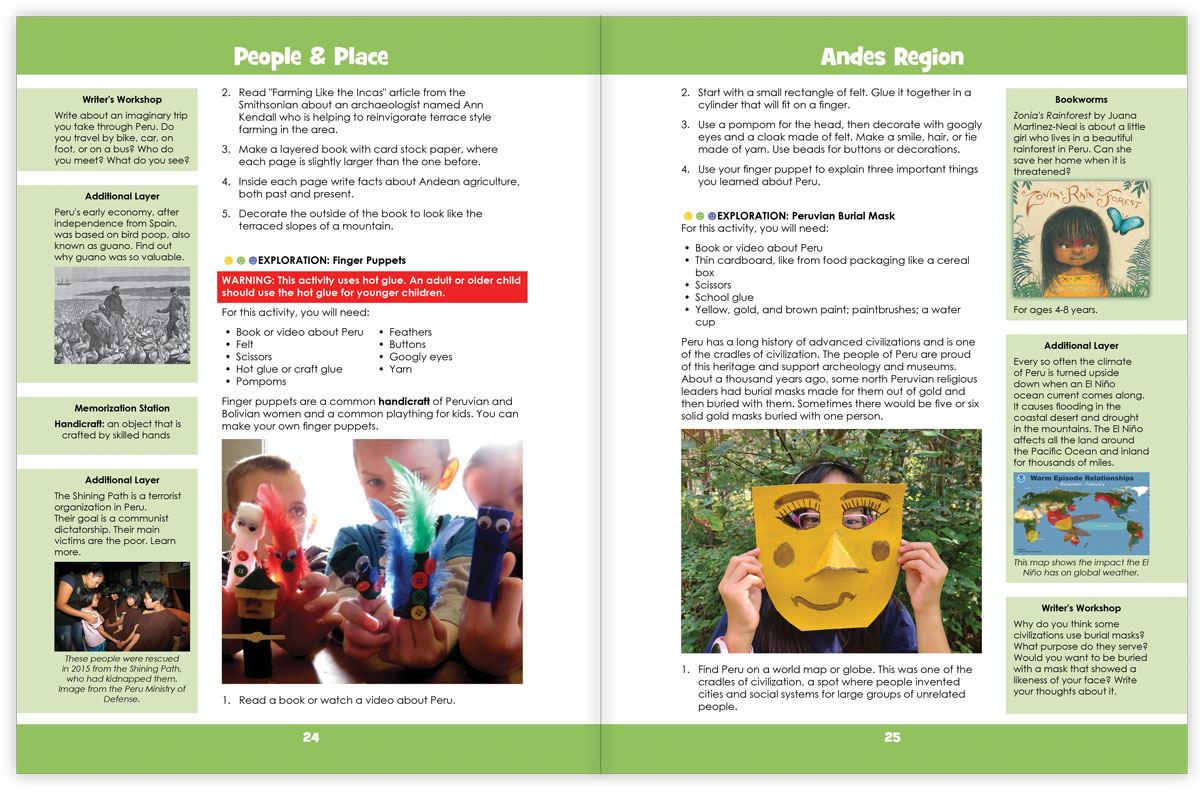
- Make a Peruvian burial mask
- Plus much more!
See Inside
This is double page spread of the inside of the Andes Region unit:
Each Layers of Learning Geography unit includes library lists of books, a family read-aloud suggestion, hands-on activities, printables and paper crafts, sidebars for extra learning, and tools to help you assess student’s progress and mastery. Learn more about how Layers of Learning works.
Flexibility
This unit was written to be used for a month but contains plenty of content for many more weeks of learning if you choose. This is a pick-and-choose curriculum, meant to be cycled back to in the future when your child is older. As such, it intentionally includes far more material than you can possibly cover in a month.
Andes Region is also part of the overall People & Place course, the fourth Year of the four-year Layers of Learning Geography cycle. If you use the program in order, it will take you though the geography of the world from continents and the physical planet in Year One, to mapping skills in Year Two, then to cultures in Year Three, and finally, to government and society in Year Four. Every year is also a tour of the whole planet, making stops on every continent. However, each unit stands alone and can be used independently of any other unit.
Printable Pack
This unit comes with a downloadable Printable Pack that includes all the student worksheets. The printables can be copied as many times as needed for your family or class.
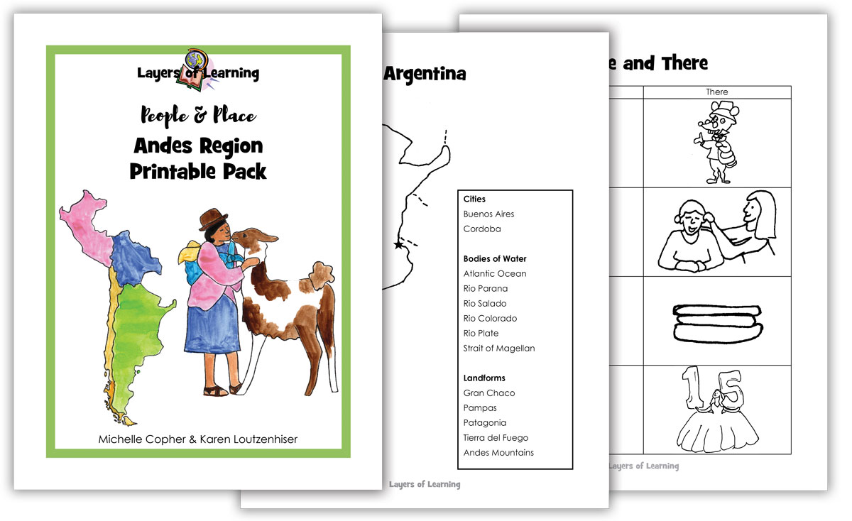
You can download the Printable Pack from your receipt or from your account at Layers of Learning.
Extra Resources
This unit comes with extra weblinks and a YouTube video playlist on the People & Place Resources page.
Reviews
There are no reviews yet.